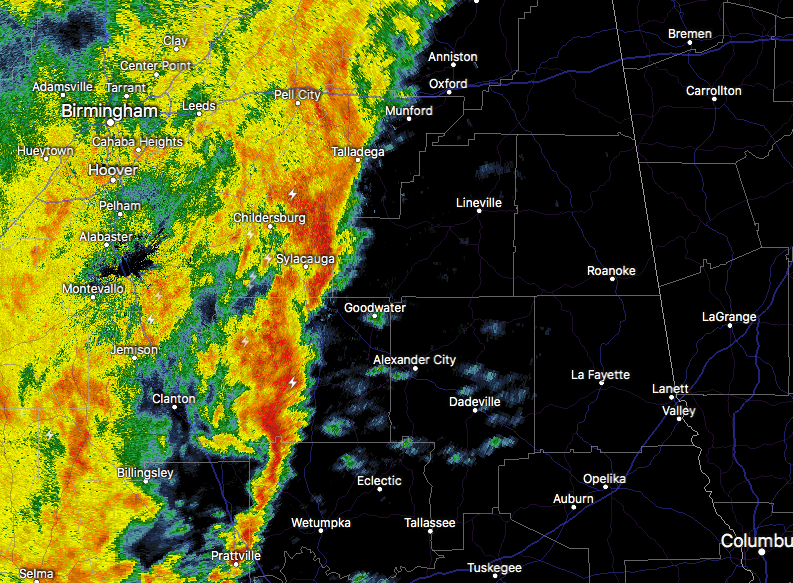
At 4:03 PM CDT, Doppler radar was tracking strong thunderstorms along a line extending from near Sylacauga to near Deatsville. Movement was east at 35 mph. Winds in excess of 40 mph will be possible with these storms.
Therefore, NWS Birmingham has issued a Significant Weather Advisory for southeastern Talladega, northern Elmore, northwestern Tallapoosa, Coosa, and Clay counties until 5:00 PM.
Locations impacted include…
Alexander City, Millbrook, Sylacauga, Wetumpka, Lineville, Ashland, Goodwater, Rockford, Kellyton, Equality, Stewartville, Weogufka, Elmore, Coosada, Deatsville, Eclectic, Jacksons’ Gap, New Site, Waldo and Goldville.
Torrential rainfall is also occurring with these storms, and may lead to localized flooding. Do not drive your vehicle through flooded roadways.
Frequent cloud to ground lightning is occurring with these storms. Lightning can strike 10 miles away from a thunderstorm. Seek a safe shelter inside a building or vehicle.
from The Alabama Weather Blog https://www.alabamawx.com/?p=156104
No comments:
Post a Comment