BULLETIN – IMMEDIATE BROADCAST REQUESTED
Severe Thunderstorm Warning
National Weather Service Birmingham AL
908 AM CST WED FEB 7 2018
The National Weather Service in Birmingham has issued a
* Severe Thunderstorm Warning for…
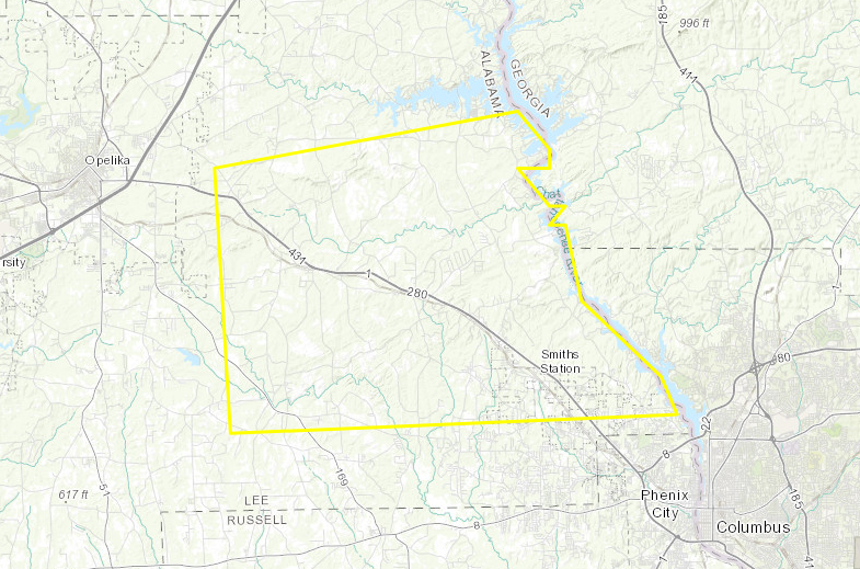
Northeastern Lee County in east central Alabama…
* Until 945 AM CST
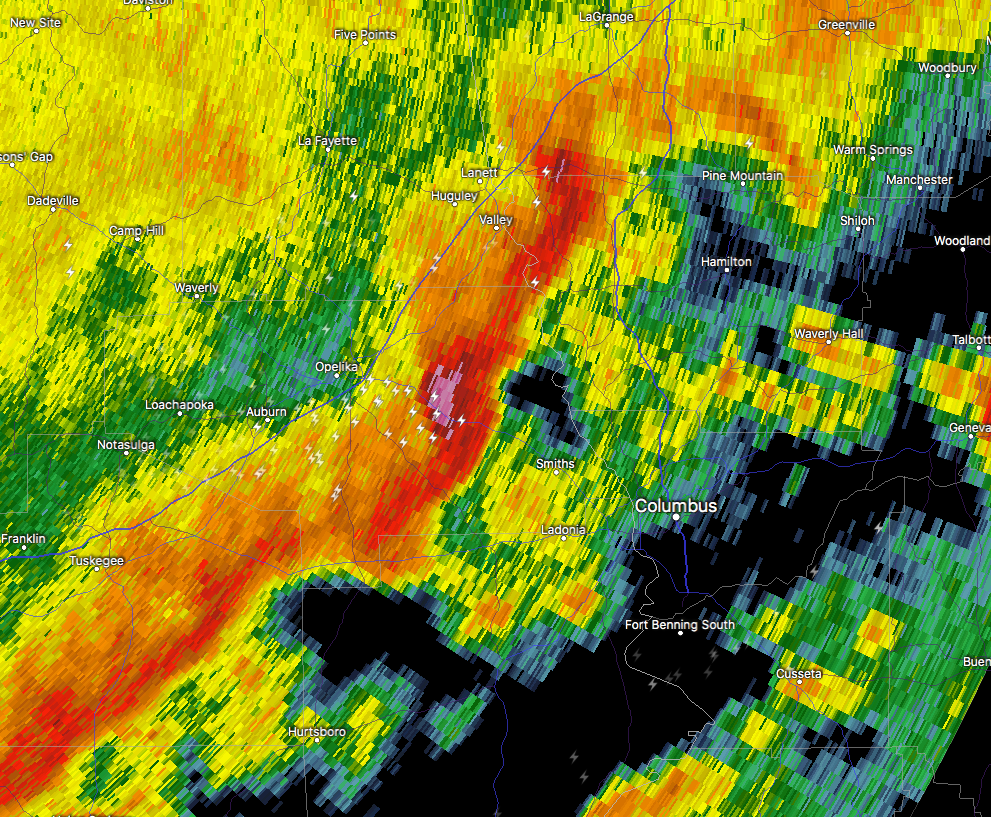
* At 908 AM CST, a severe thunderstorm was located near Bleecker, or
9 miles southeast of Opelika, moving east at 55 mph.
HAZARD…60 mph wind gusts and nickel size hail.
SOURCE…Radar indicated.
IMPACT…Expect damage to roofs, siding, and trees.
* Locations impacted include…
Smiths, Smiths Station, Bleecker, Griffen Mill, Goat Rock Lake and
Bartletts Ferry Dam.
PRECAUTIONARY/PREPAREDNESS ACTIONS…
For your protection move to an interior room on the lowest floor of a
building.
from The Alabama Weather Blog https://www.alabamawx.com/?p=152477
No comments:
Post a Comment