
GOES-16 (left) and GOES-17 (right) visible (0.64 µm) imagery of Michael starting at 1147 UTC on 8 October 2018 (Click to play animated gif)
GOES-17 data in this post are preliminary and non-operational
CONUS (Contiguous United States) imagery at 5-minute intervals from GOES-16 at 75.2 W Longitude and GOES-17 at 89.5 W Longitude allows for Hurricane Michael to be viewed stereroscopically from space. The animation above, starting at 1142 UTC, shows an intensifying Michael with strong convection developing over the center. To view in three dimensions, cross you eyes until 3 images are present, and focus on the image in the center. Very strong shear is also apparent northeast of Michael. Low-level winds and upper-level winds do not align, and convection there is strongly tilted. (This graphic of shear is from the CIMSS Tropical Weather Website)
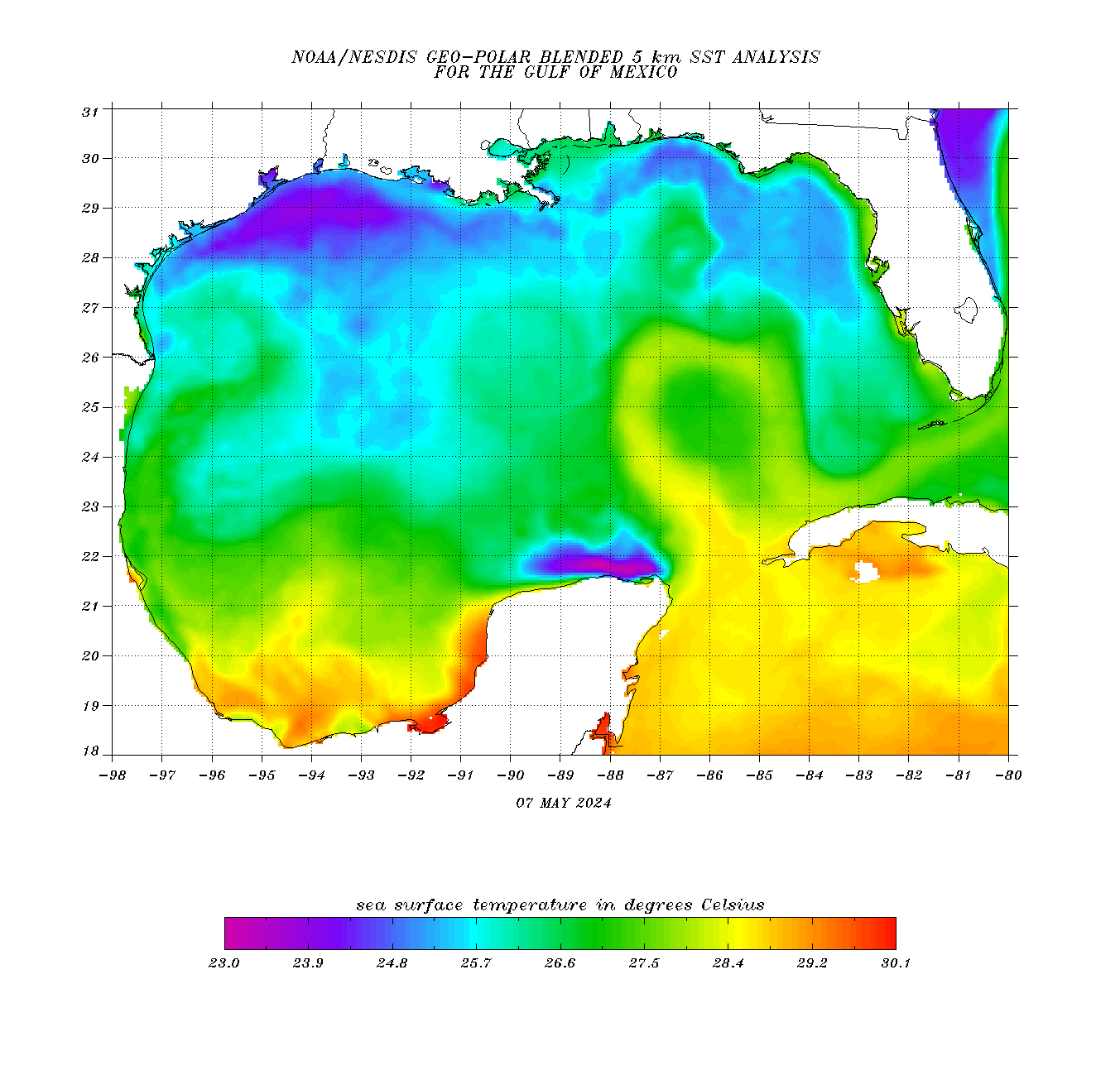
Sea-surface Temperatures over the Gulf (Source), below, show abundant warm water between Michael and its project landfall location along the northeast Gulf Coast (See the National Hurricane Center for latest information).

Blended SST over the Gulf of Mexico, 7 OCtober 2018 (Click to enlarge)
from CIMSS Satellite Blog http://cimss.ssec.wisc.edu/goes/blog/archives/30148


No comments:
Post a Comment